LiDAR is short for Light Detection and Ranging Technology, as a core concept is a fairly simple concept that is not unlike the concept of radar.
What is LiDAR?
LiDAR technology essentially consists of a powerful laser that emits invisible pulses that reflect off of surfaces and return to the sensor. These pulses are used to precisely measure the distance between the laser and the return point. The biggest advantage of this technology is the ability to fire the laser beam very quickly and collect very dense data from a large area.
How does LiDAR work?
LiDAR (Light Detection and Ranging) is a technology that was originally developed by NASA as a means to quickly and accurately measure great distances. After ten years of development and innovation light detection technology has been diversified to be extremely useful to many different industries.
Both LiDAR and radar technology use a particular signal that is emitted and then returned after striking a certain point. The time that it takes the signal to travel to and from the measuring point gives the operator a very accurate measurement of the distance between the sensor and the object.
The difference between the two technologies is that radar uses electromagnetic wave pulses and LiDAR uses rapid laser pulses. When a radar/radio signal is transmitted it “bounces” off any object in its path which returns a slight signal back to the receiver.
The total time of the signal “trip” is calculated and then the speed at which the signal travels is used to calculate exactly how far away the object is, how fast it is traveling and the direction it is going. Radar systems are an aging technology that is not very effective for exact measurements.
LiDAR systems need to operate at a much closer proximity to what they are collecting data from, but most systems are capable of collecting millions of highly accurate measurements in just minutes.
LiDAR data However Works Somewhat Differently.
Radar data is defined as an “electromagnetic wave” of detection which returns a faint (and sometimes very general) signal with very little detailed information about the object.
Radar technology will sense anything that is within its path so it is not uncommon to mistake a radar signal return that is actually a large flock of birds for a small aircraft. Instead of arbitrary return signals, LiDAR collects its data in something more like a point cloud.
One of the many practical uses of LiDAR technology is that the laser is often scattered as it pulses and this creates a very dense point return. Millions of pulses are emitted and those millions of pulses strike a surface and then return to the sensor. This dense point data is often used to create 3D models of a particular environment or to view detailed topography information.
The laser points that are collected are often dense enough to have the appearance of pixels however the difference is that these points designate elevation and distance instead of color.
What is LiDAR Used for?
The number of industry applications for LiDAR data is astonishing. Some of the applications for LiDAR could dramatically alter our world even though many people are unfamiliar with what the technology even is. One of these applications is LiDAR-equipped automobiles capable of sensing each other and the environments around them.
LiDAR point data could be used in traffic by placing sensors on every vehicle, taking detailed information from the vehicle’s environment to help make navigation decisions for the driver. In fact, when LiDAR is combined with video and other sensor technologies, totally autonomous driving has been proven to be expensive but completely possible.
This kind of technology would dramatically decrease traffic accidents and eventually enable drivers to become passengers if they choose to do so. Google has been the most active in this technology niche.
The combined sensors, flag-shipped by the mounted LiDAR sensors were actually able to navigate a “driver seat supervised” Audi TT around LA for about 200,000 miles. Using solely Google servers and LiDAR information mapping technology several equipped Prius and Audi vehicles were able to navigate busy downtown LA traffic and motorways. This is of course a technology that has a long journey to total fruition, but LiDAR gives us the ability to push these concepts to the limit.
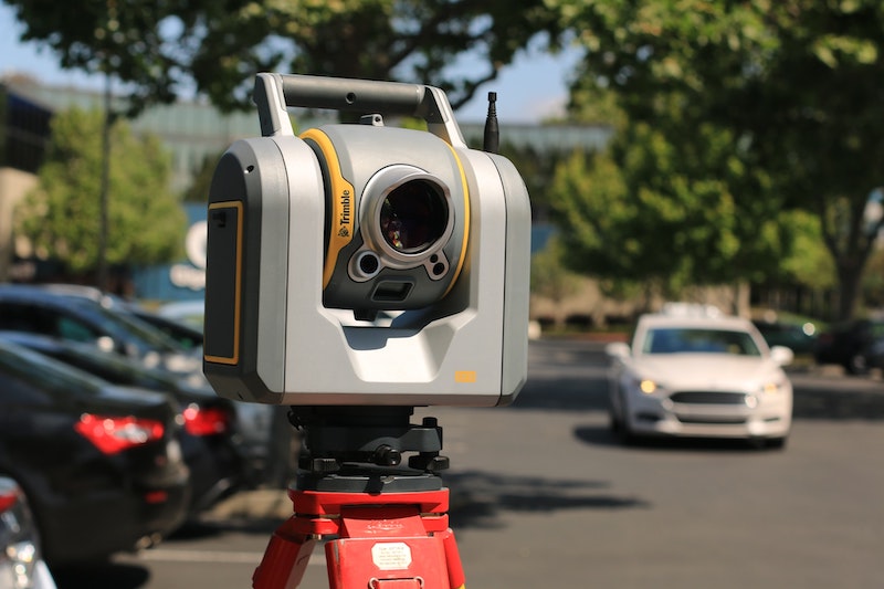
The most common application for LiDAR technology is currently aerial geographical survey. In this industry, survey companies are being hired to use LiDAR scanning sensors to take very dense topographical data from essentially any landscape.
This very dense and accurate data is used for flood level detection, construction, development, forest vegetation analysis, and any other task that would require detailed elevation data.
Many survey companies have switched from older scanning technologies to LiDAR scanning simply because it can often be accomplished much more quickly than many other kinds of survey techniques making it the most popular technology application in that field.
The fact that LiDAR technology is able to take high-accuracy data more quickly than other technologies also makes the process cheaper which makes the service more attractive to clients as well.
What is the future of LiDAR?
The accuracy of this technology varies depending on the quality of your equipment and the measurement distances. However LiDAR point data can be accurate to anywhere from a meter to within a centimeter depending on the particular application of the technology and specifications of the situation.
Like many technologies, the accuracy of the LiDAR system is limited to the quality of the laser and the many other components that are necessary to the process.
The progression of LiDAR data collection seems to be very much like the progression of GPS technology in the 1990s. Global Positioning Sytems is a very useful technology that was designed for a very specific purpose, but over time the full potential of the technology was realized. GPS technology is almost exclusively trusted to control the safe travel of millions of airline passengers around the world.
However, through its development and application, it can also give me specific driving directions from my current address to the nearest Starbucks in seconds. I doubt the developers of GPS technology intended it for personal and urban navigation but often times it is impossible to know the true limits of a particular technology until it is reached.
The main barrier to using LiDAR data systems of any kind is that they are typically extremely expensive. However, like most technologies with time, the cost should decrease and more people will have access to this kind of equipment.
However, in order for any new LiDAR aspirations to be accomplished they must first be imagined… so what would you use LiDAR technology for?
Read also: